





Last updated: September 2026 · Prices & availability verified for the 2026/2027 season
Mount Lewotobi Laki-laki sits at the far eastern tip of Flores, about 540-600 kilometers from Labuan Bajo at the island’s far western tip, and further still from Komodo National Park, which lies west of town across sheltered park waters. That is roughly the distance from Paris to Zurich. Sailings are running normally, Komodo Airport is operating, and the 5-kilometer exclusion zone around the volcano is exactly that: 5 kilometers, on the other end of a 660-km-long island.
The Map That Answers Everything
Bali → Flores → Komodo: where the locations actually are
Lewotobi Laki-laki is in East Flores. Labuan Bajo is at the western end of Flores, and Komodo National Park lies west of Labuan Bajo across the surrounding islands and straits.
Note: Flores is roughly 350–360 km long geographically. The longer 540–600 km figure refers to the approximate overland journey between Labuan Bajo and the Lewotobi area, not to the island’s end-to-end length.
What Actually Happened on 27 August
Mount Lewotobi Laki-laki erupted at about 08.30 WITA on Thursday, 27 August 2026, with an ash column of about 2,500 meters above the summit. Indonesia’s Geological Agency was direct: this is normal activity for this volcano, part of a steady, well-monitored eruption pattern that has recurred dozens of times through 2026. The alert stands at Level III (Siaga), notably lower than the Level IV of late 2025, residents, visitors, and tourists were advised not to carry out activities within a 5 km radius of the eruption centre. Not around Flores. Not around NTT. Five kilometers, around the summit.
On the ground in Labuan Bajo: Komodo Airport operating, harbors serving vessels as usual, park sailings departing on schedule, confirmed by the Labuan Bajo Flores tourism authority’s monitoring. The one honest caveat: high-altitude ash occasionally drifts west and airlines adjust routes conservatively; historically that has mostly meant disruption at Maumere’s small airport in East Flores, while Komodo Airport’s daily ash tests stay clean. If you fly in the coming days, simply keep an eye on your airline’s notifications, the same advice as any travel week.
NTT Is Enormous: a Sense of Scale
East Nusa Tenggara is not a place; it is five hundred places. The province spans more than 500 islands — Flores, Sumba, the western half of Timor, Alor, Sabu, Rote, Lembata and their many neighbors — stretched across a sweep of sea wider than some European countries. Flores alone runs about 660 kilometers end to end. Saying “a volcano erupted in NTT, is Komodo affected?” is geographically like asking whether a storm in Vienna closes the beaches of Nice. Same broad region on a world map; different worlds on the ground.
Read more: Are Flights to Labuan Bajo Affected by Mount Lewotobi? Komodo Airport Status Explained
Why Komodo Sails January Through December
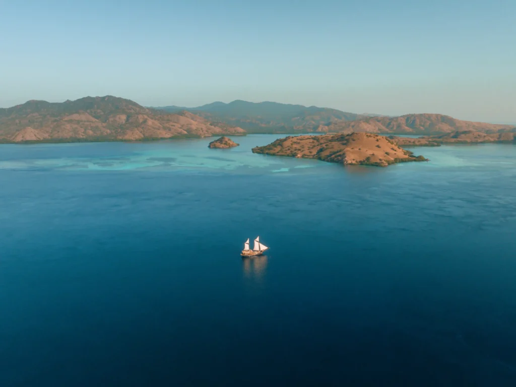
Here is the part of the geography lesson that matters most for your trip, and the reason Komodo has a year-round sailing calendar: this is island-to-island cruising, not a long offshore passage. From Labuan Bajo’s harbor, you are inside the park’s waters within about 30 minutes, and everything that follow, Padar, Pink Beach, Komodo Island, Manta Point, Taka Makassar, happens in the bays, straits and channels between islands. Sheltered water, short hops, anchorages every evening. It is, frankly, some of the calmest cruising ground in Indonesia, which is why phinisi here sail through the seasons while true open-water crossings elsewhere pause for weather.
And the Ring of Fire that occasionally makes headlines? It is the same geology that built all of this, the volcanic arc that raised Flores from the sea, sculpted Padar’s ridgelines, and laid the nutrient-rich waters that draw the mantas. People here have lived alongside it for generations; monitoring is constant, alert levels are public, airports run daily ash tests. Managed normality, not novelty.
Lewotobi Itself: The Twin Peaks Worth Knowing
Lewotobi is a twin-volcano complex in East Flores: Lewotobi Laki-laki (“the man”), the active, steep-coned twin, and Lewotobi Perempuan (“the woman”), taller and quieter beside him. East Flores communities have long read the pair as guardians of the land. From a safe distance, they are among the most beautiful stratovolcanoes in the archipelago, and one day, when the mountain rests, their trails will draw hikers the way Kelimutu’s crater lakes already do. NTT’s drama is the price and the source of its beauty.
The Exclusion Zone and Exactly Where It Ends
Indonesia’s volcanology agency (PVMBG, through the MAGMA Indonesia platform) draws a restricted radius around the crater itself, and adjusts it as the alert phase moves. Through the current episode, that radius has sat in the single digits, currently 5 km from the summit, having been widened and narrowed between roughly 4 and 8 km as phases changed, sometimes with a wider corridor along the river valleys where lahar can travel after heavy rain.
An exclusion zone of a few kilometres, drawn around a crater in East Flores, does not reach a harbour 540-600 km away in West Manggarai. Labuan Bajo has never fallen inside any Lewotobi restricted zone, and neither has any anchorage in Komodo National Park. When a headline says “Flores” and an advisory says “avoid the exclusion zone,” both are true, they are simply describing an area smaller than a single Jakarta suburb, at the far opposite end of an island the length of Great Britain.
Because the radius genuinely does change with the alert phase, the honest advice is to read it live rather than trust any article’s frozen number, including this one. MAGMA Indonesia publishes the current status and radius publicly, and our team checks it every morning before departures.
Are Komodo Tours, Liveaboards and Dragon Trekking Still Running?

Yes, the current Lewotobi exclusion zone is in East Flores and does not cover Labuan Bajo or Komodo National Park. Komodo National Park has remained open throughout, and sailings have departed on schedule. The park’s ranger stations at Loh Liang (Komodo Island) and Loh Buaya (Rinca) operate normally, so dragon trekking runs as usual, the Komodo dragons live 540 km from the volcano and have been entirely untouched by it. Padar’s viewpoint, Pink Beach, Manta Point and Taka Makassar are all unaffected; no ashfall has been recorded on any of them.
If you want to see what that means in practice, our Komodo Island sailing tour packages show the departures currently running from Labuan Bajo, 3D2N and 4D3N being the classics, with private charters for groups who want the boat to themselves.
If You Are Already in Labuan Bajo
For guests already on the ground, a short and unglamorous checklist beats any amount of reassurance:
- Sail as planned
Nothing about the eruption touches the park’s waters or its schedule. - Watch your airline app, not the news
Regional disruption has concentrated at Maumere and other East Flores airfields; Komodo Airport publishes its own status, and airlines notify route changes directly. - Keep one buffer day before an international connection
This is sound advice for any Indonesian domestic leg in any season, volcano or not. - Talk to us before you rebook anything
Our office reaches the harbourmaster, the park authority and the airlines faster than a search engine will, and a five-minute message has saved more than one guest an unnecessary cancellation.
Bookings, Changes and Travel Insurance
We are a yacht charter operator, not an insurer, so we will not pretend to interpret your policy, but two things are worth knowing before you buy one.
First, an ongoing volcanic episode may be treated as a “known event” once it has been publicly reported. Depending on the insurer, policy type and purchase date, this can limit cover for claims connected to that event. If travel insurance is important to your plans, read the policy’s volcanic activity and known-event clauses carefully, then ask your insurer directly if anything is unclear.
Second, flight disruption and tour cancellation are often covered under different parts of a policy. If a flight disruption outside your control affects your arrival, please contact our team as early as possible. The options available will depend on your vessel, departure date and the notice we receive, so we prefer to review each booking individually rather than make a blanket promise that may not suit every trip. We will explain clearly what can be moved, what cannot, and the most practical next step for your booking.
Read more: Komodo Boat Tour: Complete Guide to Komodo National Park with KomodoLuxury
Experience a Comfortable Komodo Sailing Trip with Komodo Luxury
Mount Lewotobi Laki-laki is located in East Flores, far to the east of Labuan Bajo and Komodo National Park. Komodo sailing trips continue to operate normally, with the harbor, Komodo Airport, and major destinations within the national park remaining operational. As long as official conditions and local authorities allow, you can still enjoy a Komodo sailing trip without worrying that the tourist areas around Komodo are within the volcano’s exclusion zone.
With Komodo Luxury, your journey is planned with the latest operational conditions and travel information in mind before departure. Our team is also ready to assist with your sailing arrangements so you can enjoy your time in Komodo with greater peace of mind. Contact our team and book your Komodo Island tour package to explore Komodo Island, Padar, Pink Beach, Manta Point, and other destinations from Labuan Bajo.